
We're doing early investigations to help us plan a large new sewer in your area. This sewer will be built on the west side of the Merri Creek in Craigieburn, Somerton and Campbellfield.
It will support the growing population in the Northern Growth Area, which will see more than 160,000 new homes and many new businesses built over the next 20 years.
This will add extra capacity to the sewerage network, which helps stop it from spilling into our waterways and the environments. This means safer and cleaner neighbourhoods.
These investigations will help us understand the best location for the sewer.

Map of investigation area
Frequently asked questions
Investigations in your area
When: Beginning in October 2025 and may continue into early 2026
What we're doing at various locations in the area:
- Checking for existing services near our boreholes sites- We'll use scanning equipment and radar to locate water, sewer, gas and telecommunications and electrical services. This usually takes less than a day at each site.
- Non-destructive digging - Where infrastructure services are close to our borehole locations, we’ll use a vacuum truck and high-pressure water hose to safely expose them. This minimises the risk of damage and typically takes one day.
- Geotechnical investigations - A drill rig creates a narrow, vertical borehole up to 50 meters deep. We remove soil and rock samples for testing and may install a groundwater monitoring bore. Depending on ground conditions and weather, this work can take up to two weeks and may involve short detours, traffic management and periods of loud noise.
What to expect if you're local to these investigations:
- With the geotechnical investigations, may be at each borehole site for up to two weeks.
- Working hours are Monday to Friday, 7 am to 5 pm.
- Specialist equipment and machinery will be onsite, with extra vehicles parked in nearby streets.
- Some work will create noise and dust. We’ll do our best to keep this to a minimum.
- Temporary fencing will surround each site and traffic management will be in place when needed.
- When we finish, we’ll restore each site as close as possible to its original condition.
- Water and sewer services will not be interrupted.
- Some areas we’re working in are classified as having Aboriginal cultural heritage sensitivity under the Aboriginal Heritage Act 2006. In these areas, a Cultural Heritage Management Plan (CHMP) is required.
- Assessments are carried out by heritage specialists and may involve background research, site inspections and ground testing using small tools or scanning equipment.
- In more sensitive areas, small test pits may be dug by hand or with equipment under the supervision of an archaeologist.
- All plans must be reviewed and approved by the Registered Aboriginal Party before works can proceed.
When: July 2025 to February 2026
- Small roof tiles will be placed on the ground from July to provide shelter for lizards, making it easier to detect them.
- Flagging tape or bunting may be used to restrict access to ensure tiles are not damaged during the survey season.
- Tiles are spaced out across suitable habitat and checked regularly from September to February by trained staff when lizards are most active (on cooler days).
- Tiles are installed by hand, sometimes carried using wheelbarrows where vehicles can’t access the area.
- No habitat is removed or disturbed, and all work is done in accordance with ecological survey guidelines.
Image of tile
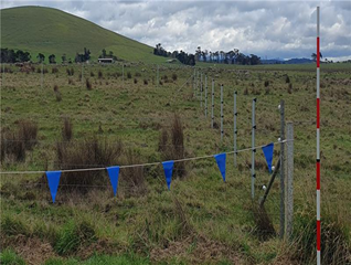
Image of bunting
When: June to August 2025
- We'll assess the condition and type of vegetation, such as native grasslands, woodlands and wetland areas.
- We’ll measure trees, map vegetation and take photos to document the site – all using GPS and mobile mapping tools.
- We’ll also look for rare winter-flowering plants, walking through the habitat to carefully check for these species.
- All assessments are done on foot and are completely non-invasive.
When: Initial habitat check - June to August 2025
Targeted surveys (if needed): September – November 2025
- Ecologists will check spider holes or other burrows by inserting a small camera (borescope) to assess if the ground could support this species.
- If suitable habitat is found, small artificial burrows (spider tubes) and roof tiles may be installed to encourage dragon activity.
- These will be checked up to 3 times a week during the peak survey season.
When: November 2025 to January 2026
- These frogs are most active at night during the warmer, wetter months when they breed.
- Ecologists will do night-time surveys near water bodies, listening for frog calls and using torches to visually confirm their presence.
- Pre-recorded frog calls may be played using speakers to encourage responses.
- Surveys will take place from 8:30 pm to midnight, over at least 2 nights per location.
- Local police will be notified when surveys happen on public land for safety.
When: September to November 2025
- Ecologists will walk through suitable areas to search for rare spring-blooming plants.
- Surveys are carefully timed to match flowering periods, improving the chance of detecting species.
- Any plants found will be recorded using accurate GPS tools, and no vegetation will be removed or disturbed.
- All work is carried out on foot and is completely non-invasive.
The results will be uploaded into the Victorian Biodiversity Atlas, which is publicly accessible. The Atlas does not publish sensitive information such as property details.
If we discover any Aboriginal Cultural Heritage artefacts, we’ll work closely with the Wurundjeri Woi Wurrung Cultural Heritage Aboriginal Corporation to make sure that artefacts are properly handled, protected and respected in line with cultural guidelines.


